


st guilhem

Castor3467
User
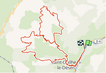

Length
21 km

Max alt
533 m

Uphill gradient
940 m
Km-Effort
33 km

Min alt
66 m

Downhill gradient
942 m
Boucle
Yes
Creation date :
2018-04-17 11:42:08.222
Updated on :
2018-04-17 11:42:08.222
6h50
Difficulty : Difficult

FREE GPS app for hiking
 SityTrail
IGN / Geographical institutes
SityTrail Plus
The world is yours!
About
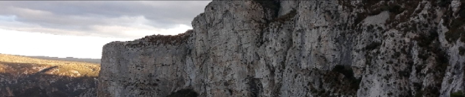
Trail Walking of 21 km to be discovered at Occitania, Hérault, Saint-Guilhem-le-Désert. This trail is proposed by Castor3467.
Photos


Positioning
Country:
France
Region :
Occitania
Department/Province :
Hérault
Municipality :
Saint-Guilhem-le-Désert
Location:
Unknown
Start:(Dec)
Start:(UTM)
545010 ; 4843222 (31T) N.
Comments