


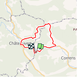
Correns - Le val Sourn

soca
User

Length
11.2 km

Max alt
356 m

Uphill gradient
295 m
Km-Effort
15.2 km

Min alt
166 m

Downhill gradient
295 m
Boucle
Yes
Creation date :
2018-04-17 11:57:29.572
Updated on :
2018-04-17 11:57:29.572
3h16
Difficulty : Medium

FREE GPS app for hiking
 SityTrail
IGN / Geographical institutes
SityTrail Plus
The world is yours!
About
Trail Walking of 11.2 km to be discovered at Provence-Alpes-Côte d'Azur, Var, Correns. This trail is proposed by soca.
Positioning
Country:
France
Region :
Provence-Alpes-Côte d'Azur
Department/Province :
Var
Municipality :
Correns
Location:
Unknown
Start:(Dec)
Start:(UTM)
261033 ; 4819663 (32T) N.
Comments
beau circuit