


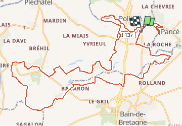
05.11.2017 - De Poligné au nord de Bain.Virtuel.2

babeth35
User

Length
34 km

Max alt
122 m

Uphill gradient
538 m
Km-Effort
42 km

Min alt
15 m

Downhill gradient
537 m
Boucle
Yes
Creation date :
2018-04-17 12:22:30.523
Updated on :
2020-07-20 15:10:30.504
8h52
Difficulty : Medium

FREE GPS app for hiking
 SityTrail
IGN / Geographical institutes
SityTrail Plus
The world is yours!
About
Trail Walking of 34 km to be discovered at Brittany, Ille-et-Vilaine, Pléchâtel. This trail is proposed by babeth35.
Positioning
Country:
France
Region :
Brittany
Department/Province :
Ille-et-Vilaine
Municipality :
Pléchâtel
Location:
Unknown
Start:(Dec)
Start:(UTM)
598774 ; 5303891 (30T) N.
Comments