


83 - TRANS-EN-PROVENCE - Peïcal-Sud

AndreLACOMBE
User
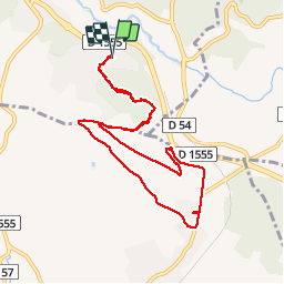

Length
9.8 km

Max alt
190 m

Uphill gradient
207 m
Km-Effort
12.5 km

Min alt
104 m

Downhill gradient
206 m
Boucle
Yes
Creation date :
2018-04-17 12:25:59.399
Updated on :
2018-04-17 12:25:59.399
2h24
Difficulty : Easy

FREE GPS app for hiking
 SityTrail
IGN / Geographical institutes
SityTrail Plus
The world is yours!
About
Trail Walking of 9.8 km to be discovered at Provence-Alpes-Côte d'Azur, Var, Trans-en-Provence. This trail is proposed by AndreLACOMBE.
Description
Boucle par chapelle Sainte-Roseline
Positioning
Country:
France
Region :
Provence-Alpes-Côte d'Azur
Department/Province :
Var
Municipality :
Trans-en-Provence
Location:
Unknown
Start:(Dec)
Start:(UTM)
297898 ; 4818464 (32T) N.
Comments