


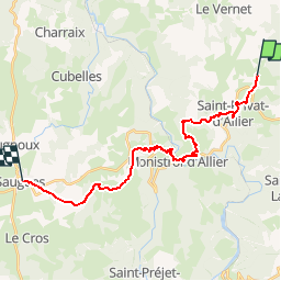
Compostelle 02 - Rougeac -> Saugues

uru2010
User

Length
23 km

Max alt
1101 m

Uphill gradient
721 m
Km-Effort
33 km

Min alt
592 m

Downhill gradient
738 m
Boucle
No
Creation date :
2018-04-17 12:31:07.006
Updated on :
2018-04-17 12:31:07.006
8h05
Difficulty : Very difficult

FREE GPS app for hiking
 SityTrail
IGN / Geographical institutes
SityTrail Plus
The world is yours!
About
Trail Walking of 23 km to be discovered at Auvergne-Rhône-Alpes, Haute-Loire, Saint-Privat-d'Allier. This trail is proposed by uru2010.
Description
Chemin de St Jacques de Compostelle
Rougeac -> Saugues
Difficultés : descente très pentue avec des pierres.
Positioning
Country:
France
Region :
Auvergne-Rhône-Alpes
Department/Province :
Haute-Loire
Municipality :
Saint-Privat-d'Allier
Location:
Saint-Privat-d'Allier
Start:(Dec)
Start:(UTM)
554661 ; 4983891 (31T) N.
Comments