


2017-11-11 montargis 50 km

Lucquiaud
User

Length
50 km

Max alt
143 m

Uphill gradient
545 m
Km-Effort
58 km

Min alt
85 m

Downhill gradient
545 m
Boucle
Yes
Creation date :
2018-09-15 15:03:12.15
Updated on :
2018-09-15 15:03:12.3
3h40
Difficulty : Unknown

FREE GPS app for hiking
 SityTrail
IGN / Geographical institutes
SityTrail Plus
The world is yours!
About
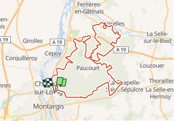
Trail Mountain bike of 50 km to be discovered at Centre-Loire Valley, Loiret, Montargis. This trail is proposed by Lucquiaud.
Positioning
Country:
France
Region :
Centre-Loire Valley
Department/Province :
Loiret
Municipality :
Montargis
Location:
Unknown
Start:(Dec)
Start:(UTM)
481060 ; 5317639 (31U) N.
Comments