


CROUY FERTE_backup

olivieraron
User
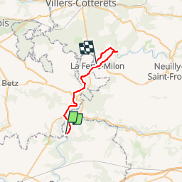

Length
24 km

Max alt
139 m

Uphill gradient
264 m
Km-Effort
28 km

Min alt
55 m

Downhill gradient
254 m
Boucle
No
Creation date :
2019-01-14 09:42:45.904
Updated on :
2019-01-14 09:42:46.031
8m
Difficulty : Unknown

FREE GPS app for hiking
 SityTrail
IGN / Geographical institutes
SityTrail Plus
The world is yours!
About
Trail Other activity of 24 km to be discovered at Ile-de-France, Seine-et-Marne, Crouy-sur-Ourcq. This trail is proposed by olivieraron.
Positioning
Country:
France
Region :
Ile-de-France
Department/Province :
Seine-et-Marne
Municipality :
Crouy-sur-Ourcq
Location:
Unknown
Start:(Dec)
Start:(UTM)
504656 ; 5437591 (31U) N.
Comments