


Trail Tour d'Aiguines 2018

jpb83
User
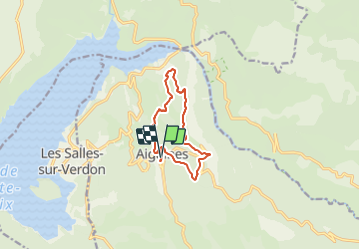

Length
10.6 km

Max alt
1091 m

Uphill gradient
606 m
Km-Effort
18.6 km

Min alt
552 m

Downhill gradient
606 m
Boucle
Yes
Creation date :
2018-04-17 12:39:25.45
Updated on :
2018-04-17 12:39:25.45
--
Difficulty : Unknown

FREE GPS app for hiking
 SityTrail
IGN / Geographical institutes
SityTrail Plus
The world is yours!
About
Trail Other activity of 10.6 km to be discovered at Provence-Alpes-Côte d'Azur, Var, Aiguines. This trail is proposed by jpb83.
Positioning
Country:
France
Region :
Provence-Alpes-Côte d'Azur
Department/Province :
Var
Municipality :
Aiguines
Location:
Unknown
Start:(Dec)
Start:(UTM)
278144 ; 4850557 (32T) N.
Comments