


sur les traces des SR

supercolas
User GUIDE
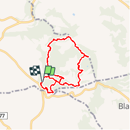

Length
7.8 km

Max alt
439 m

Uphill gradient
255 m
Km-Effort
11.2 km

Min alt
263 m

Downhill gradient
252 m
Boucle
Yes
Creation date :
2018-04-17 12:42:20.092
Updated on :
2018-04-17 12:42:20.092
1h47
Difficulty : Medium

FREE GPS app for hiking
 SityTrail
IGN / Geographical institutes
SityTrail Plus
The world is yours!
About
Trail Walking of 7.8 km to be discovered at Provence-Alpes-Côte d'Azur, Vaucluse, Mazan. This trail is proposed by supercolas.
Description
les Anges
Positioning
Country:
France
Region :
Provence-Alpes-Côte d'Azur
Department/Province :
Vaucluse
Municipality :
Mazan
Location:
Unknown
Start:(Dec)
Start:(UTM)
673702 ; 4878200 (31T) N.
Comments