


Col du Vial

jlrayon
User

Length
10.7 km

Max alt
1252 m

Uphill gradient
507 m
Km-Effort
17.5 km

Min alt
833 m

Downhill gradient
508 m
Boucle
Yes
Creation date :
2017-12-02 08:18:55.376
Updated on :
2017-12-02 08:18:55.376
3h34
Difficulty : Difficult

FREE GPS app for hiking
 SityTrail
IGN / Geographical institutes
SityTrail Plus
The world is yours!
About
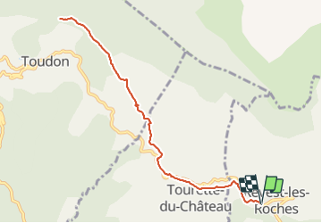
Trail Walking of 10.7 km to be discovered at Provence-Alpes-Côte d'Azur, Maritime Alps, Revest-les-Roches. This trail is proposed by jlrayon.
Description
Revest-les-Roches, col du Vial en AR
Positioning
Country:
France
Region :
Provence-Alpes-Côte d'Azur
Department/Province :
Maritime Alps
Municipality :
Revest-les-Roches
Location:
Unknown
Start:(Dec)
Start:(UTM)
351825 ; 4860369 (32T) N.
Comments