


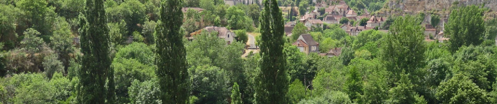
Cabrerets

houbart
User
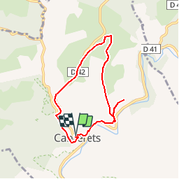

Length
6.6 km

Max alt
293 m

Uphill gradient
183 m
Km-Effort
9 km

Min alt
141 m

Downhill gradient
185 m
Boucle
Yes
Creation date :
2019-03-28 15:47:08.485
Updated on :
2019-07-26 13:50:08.224
1h58
Difficulty : Unknown

FREE GPS app for hiking
 SityTrail
IGN / Geographical institutes
SityTrail Plus
The world is yours!
About
Trail Walking of 6.6 km to be discovered at Occitania, Lot, Cabrerets. This trail is proposed by houbart.
Description
Ce petit circuit permet de découvrir l'architecture typique d'un village flanqué entre rivière et falaises où l'habitat semi-troglodytique s'accroche à la roche depuis plus d'un millénaire.
Photos


Positioning
Country:
France
Region :
Occitania
Department/Province :
Lot
Municipality :
Cabrerets
Location:
Unknown
Start:(Dec)
Start:(UTM)
392996 ; 4928991 (31T) N.
Comments