


Vallon de la Madonina

jlrayon
User
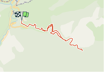

Length
11.2 km

Max alt
566 m

Uphill gradient
888 m
Km-Effort
23 km

Min alt
423 m

Downhill gradient
886 m
Boucle
Yes
Creation date :
2017-12-02 08:18:54.656
Updated on :
2017-12-02 08:18:54.656
4h34
Difficulty : Very difficult

FREE GPS app for hiking
 SityTrail
IGN / Geographical institutes
SityTrail Plus
The world is yours!
About
Trail Walking of 11.2 km to be discovered at Provence-Alpes-Côte d'Azur, Maritime Alps, Saorge. This trail is proposed by jlrayon.
Description
Projet de rando du 21/11/17
Positioning
Country:
France
Region :
Provence-Alpes-Côte d'Azur
Department/Province :
Maritime Alps
Municipality :
Saorge
Location:
Unknown
Start:(Dec)
Start:(UTM)
383988 ; 4871181 (32T) N.
Comments