


st blaise

barney06
User
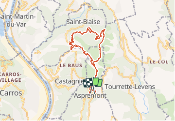

Length
16.2 km

Max alt
762 m

Uphill gradient
833 m
Km-Effort
27 km

Min alt
384 m

Downhill gradient
796 m
Boucle
No
Creation date :
2018-04-17 13:13:23.691
Updated on :
2018-04-17 13:13:23.691
7h09
Difficulty : Medium

FREE GPS app for hiking
 SityTrail
IGN / Geographical institutes
SityTrail Plus
The world is yours!
About
Trail Walking of 16.2 km to be discovered at Provence-Alpes-Côte d'Azur, Maritime Alps, Aspremont. This trail is proposed by barney06.
Description
rando
Positioning
Country:
France
Region :
Provence-Alpes-Côte d'Azur
Department/Province :
Maritime Alps
Municipality :
Aspremont
Location:
Unknown
Start:(Dec)
Start:(UTM)
358727 ; 4849458 (32T) N.
Comments