


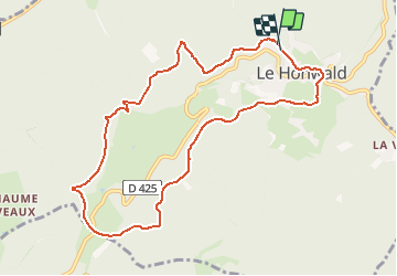
Le Hohwald et le Col du Kreutzweg

patrickbeyrath
User

Length
9.5 km

Max alt
828 m

Uphill gradient
283 m
Km-Effort
13.3 km

Min alt
567 m

Downhill gradient
287 m
Boucle
Yes
Creation date :
2018-10-13 05:54:05.296
Updated on :
2018-10-13 05:54:05.309
--
Difficulty : Medium

FREE GPS app for hiking
 SityTrail
IGN / Geographical institutes
SityTrail Plus
The world is yours!
About
Trail Walking of 9.5 km to be discovered at Grand Est, Bas-Rhin, Le Hohwald. This trail is proposed by patrickbeyrath.
Positioning
Country:
France
Region :
Grand Est
Department/Province :
Bas-Rhin
Municipality :
Le Hohwald
Location:
Unknown
Start:(Dec)
Start:(UTM)
375893 ; 5362863 (32U) N.
Comments