


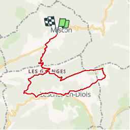
Montagne du Puy Miscon

collot
User

Length
19.6 km

Max alt
1532 m

Uphill gradient
1017 m
Km-Effort
33 km

Min alt
747 m

Downhill gradient
1006 m
Boucle
Yes
Creation date :
2018-04-17 13:32:51.0
Updated on :
2018-04-17 13:32:51.0
7h59
Difficulty : Medium

FREE GPS app for hiking
 SityTrail
IGN / Geographical institutes
SityTrail Plus
The world is yours!
About
Trail Walking of 19.6 km to be discovered at Auvergne-Rhône-Alpes, Drôme, Miscon. This trail is proposed by collot.
Positioning
Country:
France
Region :
Auvergne-Rhône-Alpes
Department/Province :
Drôme
Municipality :
Miscon
Location:
Unknown
Start:(Dec)
Start:(UTM)
700093 ; 4944551 (31T) N.
Comments