


veneux tour

Yannick.Boireau
User

Length
10.1 km

Max alt
111 m

Uphill gradient
109 m
Km-Effort
11.6 km

Min alt
40 m

Downhill gradient
109 m
Boucle
Yes
Creation date :
2018-04-17 13:41:42.383
Updated on :
2018-04-17 13:41:42.383
--
Difficulty : Unknown

FREE GPS app for hiking
 SityTrail
IGN / Geographical institutes
SityTrail Plus
The world is yours!
About
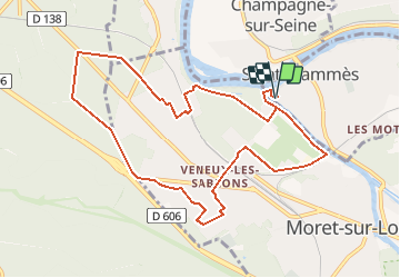
Trail Walking of 10.1 km to be discovered at Ile-de-France, Seine-et-Marne, Saint-Mammès. This trail is proposed by Yannick.Boireau.
Positioning
Country:
France
Region :
Ile-de-France
Department/Province :
Seine-et-Marne
Municipality :
Saint-Mammès
Location:
Unknown
Start:(Dec)
Start:(UTM)
485479 ; 5359249 (31U) N.
Comments