Trail Walking Unknown - Gunung Batur - Photo

Gunung Batur

 lhomme.ph
lhomme.ph

User GUIDE

© OpenStreetMap contributors
Length
Length
8 km
Max alt
Max alt
1697 m
Uphill gradient
Uphill gradient
647 m
Km-Effort
Km-Effort  
16.7 km
Min alt
Min alt
1065 m
Downhill gradient
Downhill gradient
647 m
Boucle
Boucle
Yes
Creation date :
2018-04-17 13:45:05.406
Updated on :
2018-04-17 13:45:05.406

(0 Reviews)

Walking
Walking
3h16
Difficulty : Difficult

Scan this QR Code to open this trail in the SityTrail application

FREE GPS app for hiking

Logo SityTrail SityTrail

IGN / Geographical institutes

Download SityTrail from the App Store Download SityTrail from Google Play

Logo SityTrail SityTrail World

The world is yours!

Download SityTrail from the App Store Download SityTrail from Google Play Download SityTrail on Huawei AppGallery

About

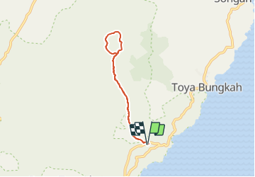
Trail Walking of 8 km to be discovered at Bali. This trail is proposed by lhomme.ph.

Description

Projet:
Ascention du mont Batur pour y admirer le lever du soleil

Elevation profile

Positioning

Country:
Indonesia
Region :
Bali
Department/Province :
Unknown
Municipality :
Unknown
Location:
Unknown
Start:(UTM)
322220 ; 9086203 (50L) S.

Trails nearby

Trail Other activity  - kitamani - Photo
Other activity
bebe73200

Other activity

Easy
(1)
, Bali, , Indonesia
11.6 km | 13.9 km-effort
1h 39min
No


Close
My subscriptions