


Etang de Chevré

chasle
User

Length
23 km

Max alt
123 m

Uphill gradient
280 m
Km-Effort
26 km

Min alt
51 m

Downhill gradient
273 m
Boucle
No
Creation date :
2018-04-17 13:46:35.938
Updated on :
2018-04-17 13:46:35.938
5h45
Difficulty : Easy

FREE GPS app for hiking
 SityTrail
IGN / Geographical institutes
SityTrail Plus
The world is yours!
About
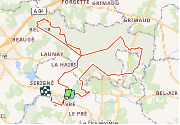
Trail Walking of 23 km to be discovered at Brittany, Ille-et-Vilaine, La Bouëxière. This trail is proposed by chasle.
Positioning
Country:
France
Region :
Brittany
Department/Province :
Ille-et-Vilaine
Municipality :
La Bouëxière
Location:
Unknown
Start:(Dec)
Start:(UTM)
614290 ; 5338800 (30U) N.
Comments