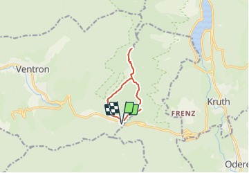
Col d'Oderen-Tête du Chat

patrickbeyrath
User

Length
8 km

Max alt
1157 m

Uphill gradient
398 m
Km-Effort
13.3 km

Min alt
891 m

Downhill gradient
396 m
Boucle
Yes
Creation date :
2018-10-13 05:54:04.384
Updated on :
2018-10-13 05:54:04.398
--
Difficulty : Medium

FREE GPS app for hiking
 SityTrail
IGN / Geographical institutes
SityTrail Plus
The world is yours!
About
Trail Walking of 8 km to be discovered at Grand Est, Vosges, Ventron. This trail is proposed by patrickbeyrath.
Description
Col d'Oderen -Abri Forestier-Tête du Chat-Abri Forestier-Auberge du Felsach-Col d'Oderen
Positioning
Country:
France
Region :
Grand Est
Department/Province :
Vosges
Municipality :
Ventron
Location:
Unknown
Start:(Dec)
Start:(UTM)
344364 ; 5309845 (32T) N.
Comments