


tour du mont aiguille

fmarois
User

Length
16.7 km

Max alt
1736 m

Uphill gradient
1124 m
Km-Effort
32 km

Min alt
1005 m

Downhill gradient
1131 m
Boucle
Yes
Creation date :
2018-04-17 14:10:43.493
Updated on :
2018-04-17 14:10:43.493
6h17
Difficulty : Difficult

FREE GPS app for hiking
 SityTrail
IGN / Geographical institutes
SityTrail Plus
The world is yours!
About
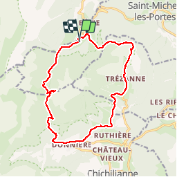
Trail Walking of 16.7 km to be discovered at Auvergne-Rhône-Alpes, Isère, Saint-Michel-les-Portes. This trail is proposed by fmarois.
Positioning
Country:
France
Region :
Auvergne-Rhône-Alpes
Department/Province :
Isère
Municipality :
Saint-Michel-les-Portes
Location:
Unknown
Start:(Dec)
Start:(UTM)
702046 ; 4970358 (31T) N.
Comments