


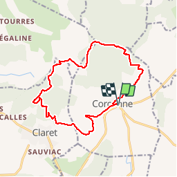
Falaises Corconne- Claret

grageot
User

Length
16.8 km

Max alt
380 m

Uphill gradient
446 m
Km-Effort
23 km

Min alt
137 m

Downhill gradient
446 m
Boucle
Yes
Creation date :
2018-04-17 14:37:17.327
Updated on :
2018-04-17 14:37:17.327
5h30
Difficulty : Medium

FREE GPS app for hiking
 SityTrail
IGN / Geographical institutes
SityTrail Plus
The world is yours!
About
Trail Walking of 16.8 km to be discovered at Occitania, Gard, Corconne. This trail is proposed by grageot.
Description
chemins au dessus de falaises, pas de difficulté topo.
Positioning
Country:
France
Region :
Occitania
Department/Province :
Gard
Municipality :
Corconne
Location:
Unknown
Start:(Dec)
Start:(UTM)
575736 ; 4858095 (31T) N.
Comments