


27/12/2017 - ST AUBIN DU CORMIER d'est en ouest.Virtuel

babeth35
User
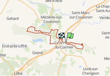

Length
29 km

Max alt
129 m

Uphill gradient
339 m
Km-Effort
34 km

Min alt
64 m

Downhill gradient
337 m
Boucle
Yes
Creation date :
2018-04-17 15:11:20.099
Updated on :
2020-07-20 15:09:04.245
7h14
Difficulty : Medium

FREE GPS app for hiking
 SityTrail
IGN / Geographical institutes
SityTrail Plus
The world is yours!
About
Trail Walking of 29 km to be discovered at Brittany, Ille-et-Vilaine, Saint-Aubin-du-Cormier. This trail is proposed by babeth35.
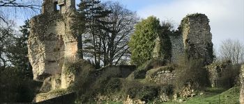
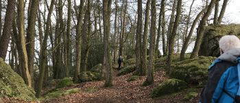
Photos


Positioning
Country:
France
Region :
Brittany
Department/Province :
Ille-et-Vilaine
Municipality :
Saint-Aubin-du-Cormier
Location:
Unknown
Start:(Dec)
Start:(UTM)
618887 ; 5346621 (30U) N.
Comments