


De Benevise à Tussac

dan48
User
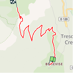

Length
4.2 km

Max alt
1580 m

Uphill gradient
552 m
Km-Effort
9.7 km

Min alt
1015 m

Downhill gradient
4 m
Boucle
No
Creation date :
2018-04-17 15:16:53.175
Updated on :
2018-04-17 15:16:53.175
2h15
Difficulty : Easy

FREE GPS app for hiking
 SityTrail
IGN / Geographical institutes
SityTrail Plus
The world is yours!
About
Trail Walking of 4.2 km to be discovered at Auvergne-Rhône-Alpes, Drôme, Châtillon-en-Diois. This trail is proposed by dan48.
Positioning
Country:
France
Region :
Auvergne-Rhône-Alpes
Department/Province :
Drôme
Municipality :
Châtillon-en-Diois
Location:
Treschenu-Creyers
Start:(Dec)
Start:(UTM)
701106 ; 4956221 (31T) N.
Comments