


sortie vtt du 07012018

fabwin
User GUIDE
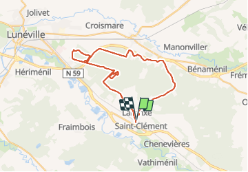

Length
28 km

Max alt
300 m

Uphill gradient
206 m
Km-Effort
30 km

Min alt
235 m

Downhill gradient
205 m
Boucle
Yes
Creation date :
2018-04-17 15:41:56.803
Updated on :
2018-04-17 15:41:56.803
2h01
Difficulty : Easy

FREE GPS app for hiking
 SityTrail
IGN / Geographical institutes
SityTrail Plus
The world is yours!
About
Trail Mountain bike of 28 km to be discovered at Grand Est, Meurthe-et-Moselle, Saint-Clément. This trail is proposed by fabwin.
Description
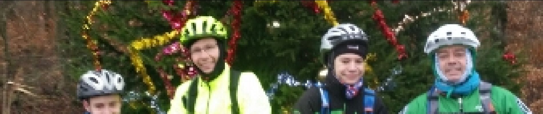
Reprise Mondon.
Avec Séb, david, Luca et Ange
Il va falloir s'y remettre sérieusement!!!!!!!
Photos


Positioning
Country:
France
Region :
Grand Est
Department/Province :
Meurthe-et-Moselle
Municipality :
Saint-Clément
Location:
Unknown
Start:(Dec)
Start:(UTM)
323022 ; 5378537 (32U) N.
Comments