


autour de Fontanes

xav34830
User
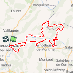

Length
40 km

Max alt
239 m

Uphill gradient
465 m
Km-Effort
46 km

Min alt
68 m

Downhill gradient
465 m
Boucle
Yes
Creation date :
2018-03-20 22:28:29.251
Updated on :
2018-03-20 22:28:29.251
--
Difficulty : Medium

FREE GPS app for hiking
 SityTrail
IGN / Geographical institutes
SityTrail Plus
The world is yours!
About
Trail Mountain bike of 40 km to be discovered at Occitania, Hérault, Saint-Mathieu-de-Tréviers. This trail is proposed by xav34830.
Description
autour de Fontanes
Positioning
Country:
France
Region :
Occitania
Department/Province :
Hérault
Municipality :
Saint-Mathieu-de-Tréviers
Location:
Unknown
Start:(Dec)
Start:(UTM)
569966 ; 4847164 (31T) N.
Comments