


val bonne

papajp
User
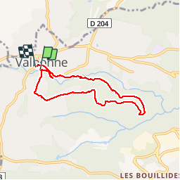

Length
6.8 km

Max alt
269 m

Uphill gradient
143 m
Km-Effort
8.7 km

Min alt
178 m

Downhill gradient
141 m
Boucle
Yes
Creation date :
2019-02-16 19:06:25.604
Updated on :
2019-02-16 19:06:25.616
1h36
Difficulty : Very easy

FREE GPS app for hiking
 SityTrail
IGN / Geographical institutes
SityTrail Plus
The world is yours!
About
Trail Walking of 6.8 km to be discovered at Provence-Alpes-Côte d'Azur, Maritime Alps, Valbonne. This trail is proposed by papajp.
Description
Super bien
Positioning
Country:
France
Region :
Provence-Alpes-Côte d'Azur
Department/Province :
Maritime Alps
Municipality :
Valbonne
Location:
Unknown
Start:(Dec)
Start:(UTM)
339368 ; 4833818 (32T) N.
Comments