


ste beaume com de l'Ai

ARPF
User
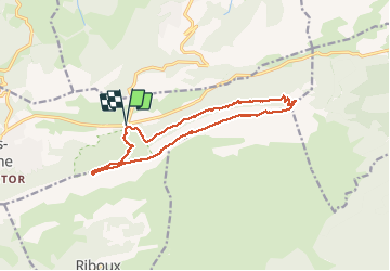

Length
14.8 km

Max alt
1143 m

Uphill gradient
599 m
Km-Effort
23 km

Min alt
680 m

Downhill gradient
596 m
Boucle
Yes
Creation date :
2018-04-17 16:56:34.035
Updated on :
2018-04-17 16:56:34.035
6h18
Difficulty : Unknown

FREE GPS app for hiking
 SityTrail
IGN / Geographical institutes
SityTrail Plus
The world is yours!
About
Trail Other activity of 14.8 km to be discovered at Provence-Alpes-Côte d'Azur, Var, Plan-d'Aups-Sainte-Baume. This trail is proposed by ARPF.
Positioning
Country:
France
Region :
Provence-Alpes-Côte d'Azur
Department/Province :
Var
Municipality :
Plan-d'Aups-Sainte-Baume
Location:
Unknown
Start:(Dec)
Start:(UTM)
724192 ; 4801824 (31T) N.
Comments