Trail Walking Chambon-sur-Lac - 
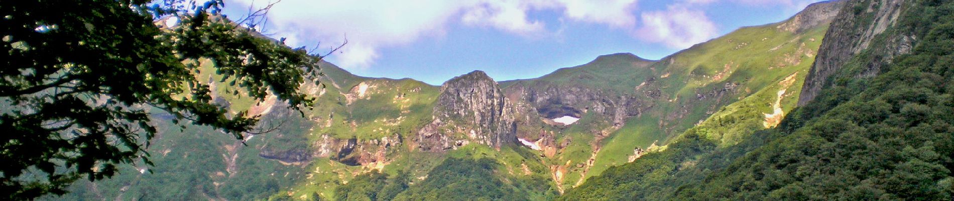
Chambon_Vallee_Chaudefour_1 - Photo
 jagarnier
jagarnier

User GUIDE

© OpenStreetMap contributors
Length
Length
14.9 km
Max alt
Max alt
1831 m
Uphill gradient
Uphill gradient
862 m
Km-Effort
Km-Effort  
26 km
Min alt
Min alt
1149 m
Downhill gradient
Downhill gradient
862 m
Boucle
Boucle
Yes
Creation date :
2018-04-17 16:59:33.443
Updated on :
2024-04-03 13:21:22.693

(0 Reviews)

Walking
Walking
6h00
Difficulty : Very difficult

Scan this QR Code to open this trail in the SityTrail application

FREE GPS app for hiking

Logo SityTrail SityTrail

IGN / Geographical institutes

Download SityTrail from the App Store Download SityTrail from Google Play

Logo SityTrail SityTrail Plus

The world is yours!

Download SityTrail from the App Store Download SityTrail from Google Play Download SityTrail on Huawei AppGallery

About

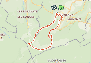
Trail Walking of 14.9 km to be discovered at Auvergne-Rhône-Alpes, Puy-de-Dôme, Chambon-sur-Lac. This trail is proposed by jagarnier.

Description

Une randonnée dans l’une des trois vallées glaciaires du massif du Sancy, sanctuaire inviolé et réserve naturelle depuis 1991. La beauté des paysages, les richesses floristiques, fauniques et géologiques rendent ce site exceptionnel.

Elevation profile

Photos

Positioning

Country:
France
Region :
Auvergne-Rhône-Alpes
Department/Province :
Puy-de-Dôme
Municipality :
Chambon-sur-Lac
Location:
Unknown
Start:(UTM)
488875 ; 5044792 (31T) N.


Close
My subscriptions