


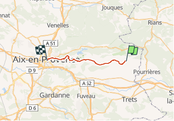
006 Puyloubier Aix en provence

MERMOZ33
User

Length
24 km

Max alt
583 m

Uphill gradient
615 m
Km-Effort
33 km

Min alt
203 m

Downhill gradient
777 m
Boucle
No
Creation date :
2018-04-17 17:01:55.833
Updated on :
2018-04-17 17:01:55.833
6h47
Difficulty : Medium

FREE GPS app for hiking
 SityTrail
IGN / Geographical institutes
SityTrail Plus
The world is yours!
About
Trail Walking of 24 km to be discovered at Provence-Alpes-Côte d'Azur, Bouches-du-Rhône, Puyloubier. This trail is proposed by MERMOZ33.
Positioning
Country:
France
Region :
Provence-Alpes-Côte d'Azur
Department/Province :
Bouches-du-Rhône
Municipality :
Puyloubier
Location:
Unknown
Start:(Dec)
Start:(UTM)
716165 ; 4822737 (31T) N.
Comments