


023 Valprivas La chapelle en lafaye

MERMOZ33
User
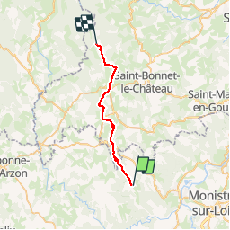

Length
24 km

Max alt
1145 m

Uphill gradient
813 m
Km-Effort
34 km

Min alt
790 m

Downhill gradient
571 m
Boucle
No
Creation date :
2018-04-17 17:04:58.007
Updated on :
2018-04-17 17:04:58.007
7m
Difficulty : Easy

FREE GPS app for hiking
 SityTrail
IGN / Geographical institutes
SityTrail Plus
The world is yours!
About
Trail Walking of 24 km to be discovered at Auvergne-Rhône-Alpes, Haute-Loire, Valprivas. This trail is proposed by MERMOZ33.
Positioning
Country:
France
Region :
Auvergne-Rhône-Alpes
Department/Province :
Haute-Loire
Municipality :
Valprivas
Location:
Unknown
Start:(Dec)
Start:(UTM)
581840 ; 5018040 (31T) N.
Comments