


Labessière Candeil 01 2018

jpipacific
User
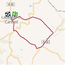

Length
6.5 km

Max alt
264 m

Uphill gradient
142 m
Km-Effort
8.4 km

Min alt
176 m

Downhill gradient
146 m
Boucle
Yes
Creation date :
2018-04-17 17:28:24.457
Updated on :
2018-04-17 17:28:24.457
1h24
Difficulty : Easy

FREE GPS app for hiking
 SityTrail
IGN / Geographical institutes
SityTrail Plus
The world is yours!
About
Trail Walking of 6.5 km to be discovered at Occitania, Tarn, Labessière-Candeil. This trail is proposed by jpipacific.
Description
Petit tour sur route d'hiver
Positioning
Country:
France
Region :
Occitania
Department/Province :
Tarn
Municipality :
Labessière-Candeil
Location:
Unknown
Start:(Dec)
Start:(UTM)
420014 ; 4850282 (31T) N.
Comments