


colorado provençal

gerardmicheline
User
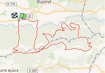

Length
16.2 km

Max alt
574 m

Uphill gradient
563 m
Km-Effort
24 km

Min alt
313 m

Downhill gradient
558 m
Boucle
Yes
Creation date :
2018-04-17 17:36:33.693
Updated on :
2021-01-10 15:06:44.453
--
Difficulty : Unknown

FREE GPS app for hiking
 SityTrail
IGN / Geographical institutes
SityTrail Plus
The world is yours!
About
Trail Walking of 16.2 km to be discovered at Provence-Alpes-Côte d'Azur, Vaucluse, Rustrel. This trail is proposed by gerardmicheline.
Positioning
Country:
France
Region :
Provence-Alpes-Côte d'Azur
Department/Province :
Vaucluse
Municipality :
Rustrel
Location:
Unknown
Start:(Dec)
Start:(UTM)
698292 ; 4865443 (31T) N.
Comments