


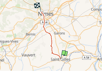
011 St Gilles Nimes raccourci

MERMOZ33
User

Length
25 km

Max alt
98 m

Uphill gradient
218 m
Km-Effort
27 km

Min alt
10 m

Downhill gradient
147 m
Boucle
No
Creation date :
2018-04-17 17:39:23.008
Updated on :
2018-04-17 17:39:23.008
--
Difficulty : Unknown

FREE GPS app for hiking
 SityTrail
IGN / Geographical institutes
SityTrail Plus
The world is yours!
About
Trail Walking of 25 km to be discovered at Occitania, Gard, Saint-Gilles. This trail is proposed by MERMOZ33.
Positioning
Country:
France
Region :
Occitania
Department/Province :
Gard
Municipality :
Saint-Gilles
Location:
Unknown
Start:(Dec)
Start:(UTM)
615524 ; 4837008 (31T) N.
Comments