Trail Walking Bormes-les-Mimosas - Chartreuse de la Verne - Photo
© OpenStreetMap contributors
Length
Length
19.3 km
Max alt
Max alt
634 m
Uphill gradient
Uphill gradient
861 m
Km-Effort
Km-Effort  
31 km
Min alt
Min alt
86 m
Downhill gradient
Downhill gradient
861 m
Boucle
Boucle
Yes
Creation date :
2018-04-17 17:45:42.842
Updated on :
2023-01-14 14:45:52.965

(2 Reviews)

Walking
Walking
6h26
Difficulty : Difficult

Scan this QR Code to open this trail in the SityTrail application

FREE GPS app for hiking

Logo SityTrail SityTrail

IGN / Geographical institutes

Download SityTrail from the App Store Download SityTrail from Google Play

Logo SityTrail SityTrail World

The world is yours!

Download SityTrail from the App Store Download SityTrail from Google Play Download SityTrail on Huawei AppGallery

About

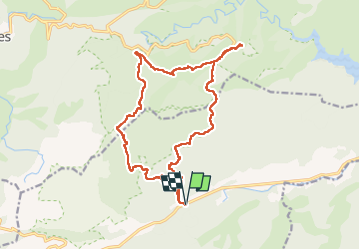
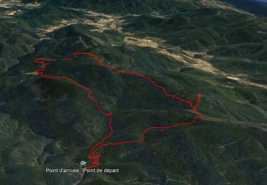
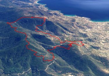
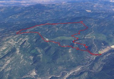
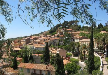
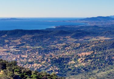
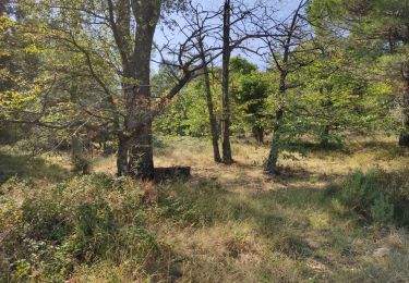
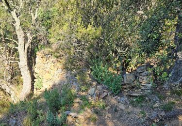
Trail Walking of 19.3 km to be discovered at Provence-Alpes-Côte d'Azur, Var, Bormes-les-Mimosas. This trail is proposed by sonneville.

Description

D559 - D98 - départ à Bargean -
le grand noyer -sommet du Péra -route de la Crête- Chartreuse de la Verne Retour par piste de Ragusse et barrage du Bousquet Le petit noyer

Elevation profile

Photos

Positioning

Country:
France
Region :
Provence-Alpes-Côte d'Azur
Department/Province :
Var
Municipality :
Bormes-les-Mimosas
Location:
Unknown
Start:(UTM)
287294 ; 4785814 (32T) N.

Comments

Please log in to post a review or rate the element


Trails nearby

Trail Walking Bormes-les-Mimosas - Les vallons de Valcros - Photo
Walking
GUIDE
affinetataille

Walking

Difficult
(1)
Bormes-les-Mimosas, Provence-Alpes-Côte d'Azur, Var, France
14 km | 22 km-effort
6h 0min
Yes
Trail Walking Collobrières - 10881733-Collobrières - La Verne - radar - Photo
Walking
GUIDE
affinetataille

Walking

Medium
(1)
Collobrières, Provence-Alpes-Côte d'Azur, Var, France
14.4 km | 21 km-effort
6h 0min
Yes
Trail Walking Bormes-les-Mimosas - SityTrail - Bormes les Mimosas - ND de Constance - Cols de Gratteloup et Landon - Photo
Walking
GUIDE
affinetataille

Walking

Difficult
(1)
Bormes-les-Mimosas, Provence-Alpes-Côte d'Azur, Var, France
13.4 km | 21 km-effort
5h 48min
Yes
Trail Walking Bormes-les-Mimosas - SityTrail - 3043274 - bargeanxchartreuse-verne - Photo
Walking
GUIDE
affinetataille

Walking

Medium
(1)
Bormes-les-Mimosas, Provence-Alpes-Côte d'Azur, Var, France
15.2 km | 23 km-effort
6h 0min
Yes
Trail Walking Bormes-les-Mimosas - Bormes les Mimosas et la Forêt des Maures - Photo
Walking
tracegps

Walking

Medium
(2)
Bormes-les-Mimosas, Provence-Alpes-Côte d'Azur, Var, France
14 km | 22 km-effort
4h 15min
Yes
Trail Walking Bormes-les-Mimosas - Col du Gratteloup - Piste domaniale Sud - Cols de Labade et Landon - Pierre d'Avenon - GR51/90 - Photo
Walking
GUIDE
affinetataille

Walking

Easy
(1)
Bormes-les-Mimosas, Provence-Alpes-Côte d'Azur, Var, France
15.1 km | 21 km-effort
6h 0min
Yes
Trail Walking Bormes-les-Mimosas - Boucle : Pont des Caunes - Piste de l'Amandier - Piste de la Gourre - Piste Lambert - Col de la Citadelle - Pont des Caunes. - Photo
Walking
GUIDE
affinetataille

Walking

Medium
Bormes-les-Mimosas, Provence-Alpes-Côte d'Azur, Var, France
15.1 km | 21 km-effort
5h 6min
Yes
Trail Walking Le Lavandou - cavaliere - Photo
Walking
lygi

Walking

Medium
(1)
Le Lavandou, Provence-Alpes-Côte d'Azur, Var, France
17.8 km | 28 km-effort
6h 59min
Yes
Trail Walking Bormes-les-Mimosas - Forêt du Dom - Photo
Walking
FSantoni

Walking

Very difficult
(1)
Bormes-les-Mimosas, Provence-Alpes-Côte d'Azur, Var, France
18.7 km | 27 km-effort
6h 5min
Yes


Close
My subscriptions