


Mahalon - Ménez Drégan

cron
User
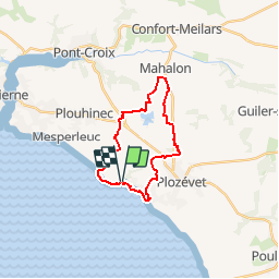

Length
19.9 km

Max alt
87 m

Uphill gradient
210 m
Km-Effort
23 km

Min alt
2 m

Downhill gradient
208 m
Boucle
Yes
Creation date :
2018-04-17 17:50:31.346
Updated on :
2018-04-17 17:50:31.346
5h00
Difficulty : Medium

FREE GPS app for hiking
 SityTrail
IGN / Geographical institutes
SityTrail Plus
The world is yours!
About
Trail Walking of 19.9 km to be discovered at Brittany, Finistère, Plouhinec. This trail is proposed by cron.
Positioning
Country:
France
Region :
Brittany
Department/Province :
Finistère
Municipality :
Plouhinec
Location:
Unknown
Start:(Dec)
Start:(UTM)
390853 ; 5315795 (30T) N.
Comments