


echaillon 3

JACQUES.FUMAT
User

Length
9 km

Max alt
1353 m

Uphill gradient
376 m
Km-Effort
14 km

Min alt
1145 m

Downhill gradient
370 m
Boucle
Yes
Creation date :
2018-04-17 18:01:05.505
Updated on :
2018-04-17 18:01:05.505
4h01
Difficulty : Unknown

FREE GPS app for hiking
 SityTrail
IGN / Geographical institutes
SityTrail Plus
The world is yours!
About
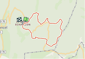
Trail Other activity of 9 km to be discovered at Auvergne-Rhône-Alpes, Drôme, Léoncel. This trail is proposed by JACQUES.FUMAT.
Positioning
Country:
France
Region :
Auvergne-Rhône-Alpes
Department/Province :
Drôme
Municipality :
Léoncel
Location:
Unknown
Start:(Dec)
Start:(UTM)
674314 ; 4975637 (31T) N.
Comments