


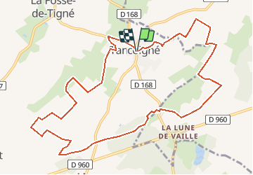
TANCOIGNE

daniel77
User

Length
12.4 km

Max alt
96 m

Uphill gradient
81 m
Km-Effort
13.5 km

Min alt
52 m

Downhill gradient
80 m
Boucle
Yes
Creation date :
2018-04-17 18:06:36.038
Updated on :
2018-04-17 18:06:36.038
2h59
Difficulty : Medium

FREE GPS app for hiking
 SityTrail
IGN / Geographical institutes
SityTrail Plus
The world is yours!
About
Trail Walking of 12.4 km to be discovered at Pays de la Loire, Maine-et-Loire, Lys-Haut-Layon. This trail is proposed by daniel77.
Positioning
Country:
France
Region :
Pays de la Loire
Department/Province :
Maine-et-Loire
Municipality :
Lys-Haut-Layon
Location:
Unknown
Start:(Dec)
Start:(UTM)
696327 ; 5227861 (30T) N.
Comments