


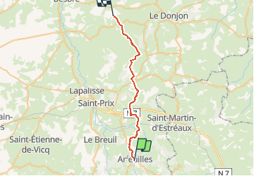
030 Arfeuille Montcombroux les mines

MERMOZ33
User

Length
31 km

Max alt
489 m

Uphill gradient
763 m
Km-Effort
42 km

Min alt
309 m

Downhill gradient
812 m
Boucle
No
Creation date :
2018-04-17 18:06:47.729
Updated on :
2018-04-17 18:06:47.729
8h42
Difficulty : Medium

FREE GPS app for hiking
 SityTrail
IGN / Geographical institutes
SityTrail Plus
The world is yours!
About
Trail Walking of 31 km to be discovered at Auvergne-Rhône-Alpes, Allier, Arfeuilles. This trail is proposed by MERMOZ33.
Positioning
Country:
France
Region :
Auvergne-Rhône-Alpes
Department/Province :
Allier
Municipality :
Arfeuilles
Location:
Unknown
Start:(Dec)
Start:(UTM)
556118 ; 5111502 (31T) N.
Comments