


Ways_Wanchet_Tassenière

denissculier
User

Length
8.1 km

Max alt
143 m

Uphill gradient
125 m
Km-Effort
9.8 km

Min alt
84 m

Downhill gradient
123 m
Boucle
Yes
Creation date :
2018-04-17 18:07:07.252
Updated on :
2018-04-17 18:07:07.252
1h55
Difficulty : Medium

FREE GPS app for hiking
 SityTrail
IGN / Geographical institutes
SityTrail Plus
The world is yours!
About
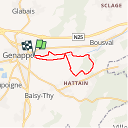
Trail Walking of 8.1 km to be discovered at Wallonia, Walloon Brabant, Genappe. This trail is proposed by denissculier.
Positioning
Country:
Belgium
Region :
Wallonia
Department/Province :
Walloon Brabant
Municipality :
Genappe
Location:
Ways
Start:(Dec)
Start:(UTM)
603460 ; 5607515 (31U) N.
Comments