La Valière

chasle
User

Length
15.8 km

Max alt
122 m

Uphill gradient
171 m
Km-Effort
18 km

Min alt
66 m

Downhill gradient
170 m
Boucle
Yes
Creation date :
2018-04-17 19:51:10.167
Updated on :
2018-04-17 19:51:10.167
3h57
Difficulty : Easy

FREE GPS app for hiking
 SityTrail
IGN / Geographical institutes
SityTrail Plus
The world is yours!
About
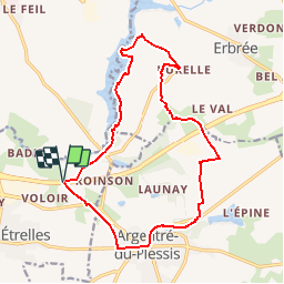
Trail Walking of 15.8 km to be discovered at Brittany, Ille-et-Vilaine, Étrelles. This trail is proposed by chasle.
Positioning
Country:
France
Region :
Brittany
Department/Province :
Ille-et-Vilaine
Municipality :
Étrelles
Location:
Unknown
Start:(Dec)
Start:(UTM)
635708 ; 5325731 (30U) N.
Comments