


guadeloupe - Trace des Falaises

soca
User

Length
11.8 km

Max alt
58 m

Uphill gradient
151 m
Km-Effort
14 km

Min alt
0 m

Downhill gradient
182 m
Boucle
No
Creation date :
2018-04-17 21:26:24.727
Updated on :
2018-04-17 21:26:24.727
3h24
Difficulty : Difficult

FREE GPS app for hiking
 SityTrail
IGN / Geographical institutes
SityTrail Plus
The world is yours!
About
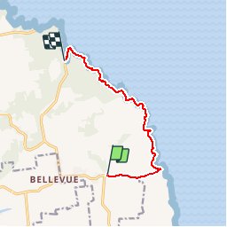
Trail Walking of 11.8 km to be discovered at Guadeloupe, Unknown, Anse-Bertrand. This trail is proposed by soca.
Positioning
Country:
France
Region :
Guadeloupe
Department/Province :
Unknown
Municipality :
Anse-Bertrand
Location:
Unknown
Start:(Dec)
Start:(UTM)
668078 ; 1818659 (20Q) N.
Comments