Trail Walking Longpont - en forêt de Retz_62_Longpont_carrefour des Alliés_AR - Photo

en forêt de Retz_62_Longpont_carrefour des Alliés_AR

forêts de France

© OpenStreetMap contributors
Length
Length
20 km
Max alt
Max alt
209 m
Uphill gradient
Uphill gradient
297 m
Km-Effort
Km-Effort  
24 km
Min alt
Min alt
86 m
Downhill gradient
Downhill gradient
296 m
Boucle
Boucle
Yes
Creation date :
2018-04-17 21:46:40.899
Updated on :
2020-11-08 13:28:34.915

(0 Reviews)

Walking
Walking
5h49
Difficulty : Difficult

Scan this QR Code to open this trail in the SityTrail application

FREE GPS app for hiking

Logo SityTrail SityTrail

IGN / Geographical institutes

Download SityTrail from the App Store Download SityTrail from Google Play

Logo SityTrail SityTrail World

The world is yours!

Download SityTrail from the App Store Download SityTrail from Google Play Download SityTrail on Huawei AppGallery

About

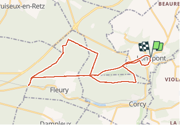
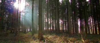
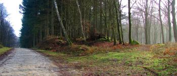
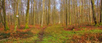
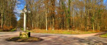
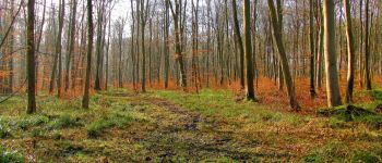
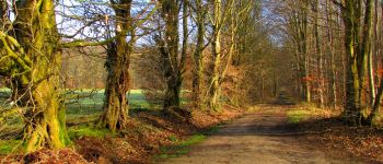
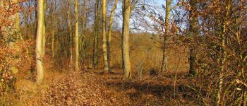
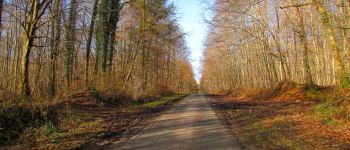
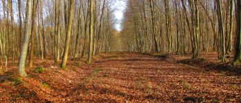
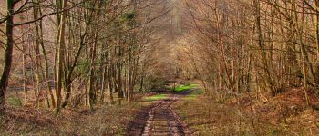
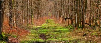
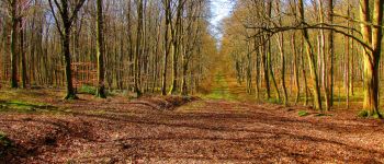
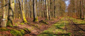
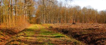
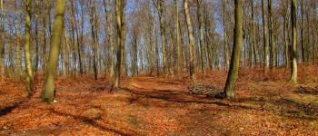
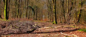
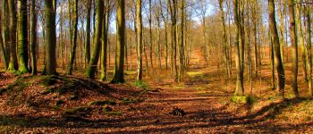
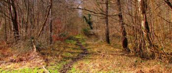
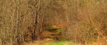
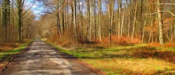
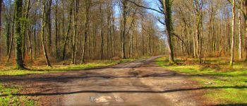
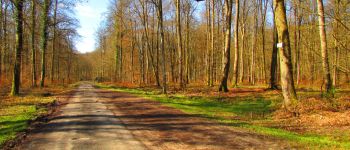
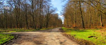
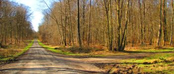
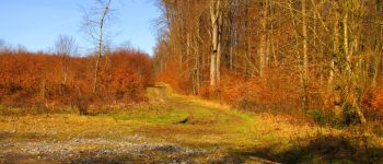
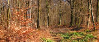
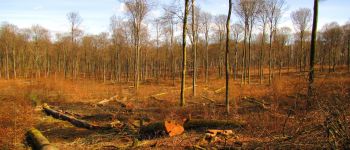
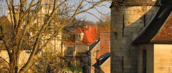
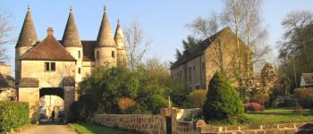
Trail Walking of 20 km to be discovered at Hauts-de-France, Aisne, Longpont. This trail is proposed by en forêt de Retz.

Description

03/ 2018

voir aussi:
http://foret-de-retz.over-blog.com/

batterie de recharge pour iphone indispensable.

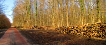
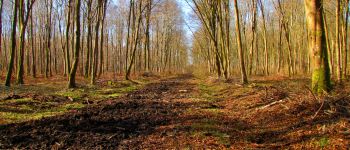
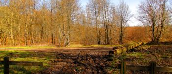
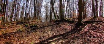
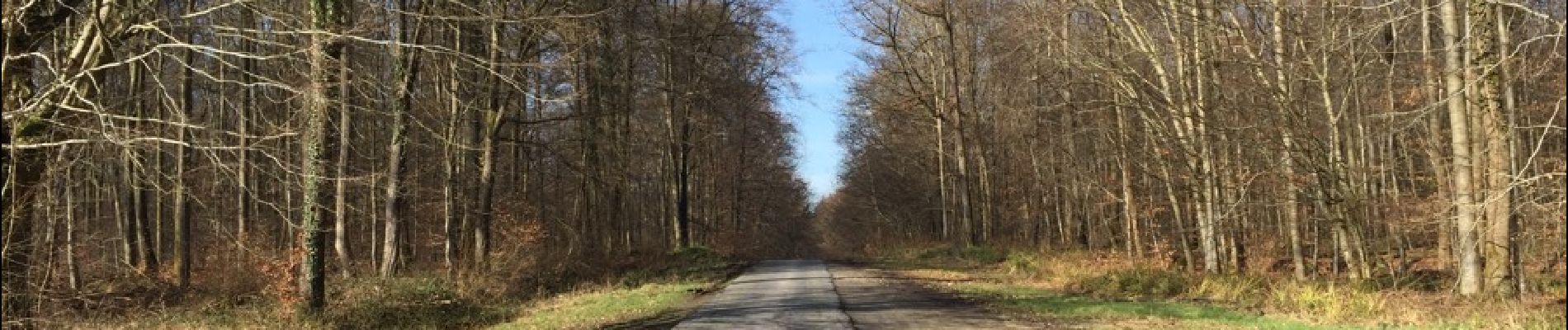
rando classée difficile en raison de la boue (débardage) en particulier sur les portions de la route Chrétiennette.

Au départ de l'abbaye de Longpont, rejoindre le GR11A
aux "trois maisons" et le suivre jusqu'au chemin de Longpont. Continuer sur ce chemin jusqu'au carrefour de la Croix Bacquet. Suivre la route du Pendu jusqu'au carrefour de la Croix de Guise. Tourner à gauche dans la route Chrétiennette et la suivre jusqu'au carrefour des Alliés. Revenir sur ses pas et suivre la route Chrétiennette jusqu'au carrefour de Retz. Prendre le chemin à gauche qui mène au carrefour de la Plaine Sissonne. Tourner à droite dans la route du Chapeau des Cordeliers et continuer jusqu'au carrefour de l'Erable. Récupérer à gauche la route Chrétiennette et la suivre jusqu'au carrefour des Monthieux. Suivre à droite la laie des Monthieux jusqu'au carrefour de Chavigny. Prendre la laie des Chamarts jusqu'au carrefour de la Croix Bacquet. Continuer sur la route du Faîte jusqu'au carrefour de Corcy. Tourner à gauche dans la laie de Corcy, traverser le carrefour du Pendu et continuer sur la laie de la Croix de Pain Tendre jusqu'au carrefour Gaudrillard. Tourner à droite dans le chemin de Longpont. Le suivre jusqu'au carrefour avec la D2. Tourner à droite pour revenir au point de départ.

Elevation profile

Photos

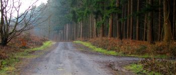
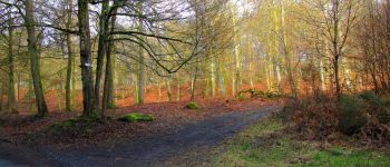
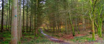
94 photos in total. Please click on a photo to see them all in the gallery.

Points of interest

Point of interest Montgobert - Point 1 - Photo
JeanLucA4
MONTGOBERT 
Point of interest Montgobert - Point 2 - Photo
JeanLucA4
MONTGOBERT 
Point of interest Montgobert - Point 3 - Photo
JeanLucA4
MONTGOBERT 
Point of interest Montgobert - Point 4 - Photo
JeanLucA4
MONTGOBERT 
Point of interest Montgobert - Point 5 - Photo
JeanLucA4
MONTGOBERT 
Point of interest Montgobert - Point 6 - Photo
JeanLucA4
MONTGOBERT 
Point of interest Montgobert - Point 7 - Photo
JeanLucA4
MONTGOBERT 
Point of interest Montgobert - Point 8 - Photo
JeanLucA4
MONTGOBERT 
Point of interest Fleury - Point 9 - Photo
JeanLucA4
FLEURY 
Point of interest Fleury - Point 10 - Photo
JeanLucA4
FLEURY 
Point of interest Fleury - Point 11 - Photo
JeanLucA4
FLEURY 
Point of interest Fleury - Point 13 - Photo
JeanLucA4
FLEURY 
Point of interest Fleury - Point 14 - Photo
JeanLucA4
FLEURY 
Point of interest Villers-Cotterêts - Point 15 - Photo
JeanLucA4
VILLERS-COTTERÊTS 
Point of interest Villers-Cotterêts - Point 16 - Photo
JeanLucA4
VILLERS-COTTERÊTS 
Point of interest Villers-Cotterêts - Point 17 - Photo
JeanLucA4
VILLERS-COTTERÊTS 
Point of interest Villers-Cotterêts - Point 18 - Photo
JeanLucA4
VILLERS-COTTERÊTS 
Point of interest Villers-Cotterêts - Point 19 - Photo
JeanLucA4
VILLERS-COTTERÊTS 
Point of interest Villers-Cotterêts - Point 20 - Photo
JeanLucA4
VILLERS-COTTERÊTS 
Point of interest Villers-Cotterêts - Point 21 - Photo
JeanLucA4
VILLERS-COTTERÊTS 
Point of interest Villers-Cotterêts - Unnamed POI - Photo
JeanLucA4
VILLERS-COTTERÊTS 
Point of interest Fleury - Point 23 - Photo
JeanLucA4
FLEURY 
Point of interest Fleury - Unnamed POI - Photo
JeanLucA4
FLEURY 
Point of interest Fleury - Point 25 - Photo
JeanLucA4
FLEURY 
Point of interest Fleury - Point 27 - Photo
JeanLucA4
FLEURY 
Point of interest Fleury - Point 28 - Photo
JeanLucA4
FLEURY 
Point of interest Montgobert - Point 29 - Photo
JeanLucA4
MONTGOBERT 
Point of interest Montgobert - Unnamed POI - Photo
JeanLucA4
MONTGOBERT 
Point of interest Montgobert - Point 31 - Photo
JeanLucA4
MONTGOBERT 
Point of interest Corcy - Point 32 - Photo
JeanLucA4
CORCY 
Point of interest Corcy - Point 33 - Photo
JeanLucA4
CORCY 
Point of interest Corcy - Point 34 - Photo
JeanLucA4
CORCY 
Point of interest Corcy - Point 35 - Photo
JeanLucA4
CORCY 
Point of interest Corcy - Point 36 - Photo
JeanLucA4
CORCY 
Point of interest Corcy - Point 37 - Photo
JeanLucA4
CORCY 
Point of interest Montgobert - Point 38 - Photo
JeanLucA4
MONTGOBERT 
Point of interest Fleury - Point 26 - Photo
JeanLucA4
FLEURY 
Point of interest Longpont - Départ - Photo
JeanLucA4
LONGPONT 
Point of interest Longpont - Arrivée - Photo
JeanLucA4
LONGPONT 

Positioning

Country:
France
Region :
Hauts-de-France
Department/Province :
Aisne
Municipality :
Longpont
Location:
Unknown
Start:(UTM)
515999 ; 5457872 (31U) N.

Trails nearby

Trail Walking Longpont - en forêt de Retz_19_Longpont_carrefour de Vauvaudran_AR - Photo
Walking

Walking

Medium
(1)
Longpont, Hauts-de-France, Aisne, France
17.5 km | 21 km-effort
4h 10min
Yes
Trail Walking Corcy - FLEURY .AISNE  - Photo
Walking
TURLUPIN2010

Walking

Medium
Corcy, Hauts-de-France, Aisne, France
5.7 km | 7.9 km-effort
1h 25min
Yes
Trail Walking Corcy - en forêt de Retz_91_04_2022_la Laie de la Belle Epine - Photo
Walking

Walking

Difficult
Corcy, Hauts-de-France, Aisne, France
10.6 km | 13.3 km-effort
3h 32min
Yes
Trail On foot Puiseux-en-Retz - Route du Faîte - Photo
On foot
PRO

On foot

Easy
Puiseux-en-Retz, Hauts-de-France, Aisne, France
5.8 km | 7.1 km-effort
1h 37min
No
Trail On foot Longpont - en forêt de Retz_22_Longpont_Rond d'Orléans_AR - Photo
On foot

On foot

Medium
Longpont, Hauts-de-France, Aisne, France
14.6 km | 17.5 km-effort
Unknown
Yes
Trail Walking Montgobert - en forêt de Retz_83_les Champs Mentard_le Fond d'Argent - Photo
Walking

Walking

Medium
Montgobert, Hauts-de-France, Aisne, France
13.6 km | 16.2 km-effort
3h 46min
Yes
Trail Walking Longpont - en forêt de Retz_77_Longpont_Puiseux en Retz_AR - Photo
Walking

Walking

Difficult
Longpont, Hauts-de-France, Aisne, France
22 km | 27 km-effort
6h 4min
Yes
Trail Walking Montgobert - en forêt de Retz_75_promenade familiale tout temps - Photo
Walking

Walking

Very easy
Montgobert, Hauts-de-France, Aisne, France
3.9 km | 4.7 km-effort
1h 25min
Yes
Trail Walking Longpont - en forêt de Retz_73_ballade (5) en toute saison - Photo
Walking

Walking

Easy
Longpont, Hauts-de-France, Aisne, France
9.1 km | 10.8 km-effort
2h 6min
Yes


Close
My subscriptions