


warnoumont

Mullender
User
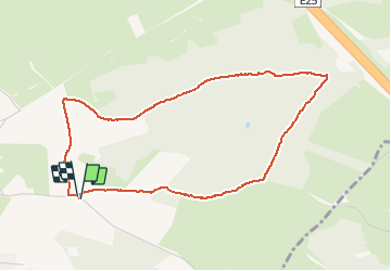

Length
4.1 km

Max alt
320 m

Uphill gradient
85 m
Km-Effort
5.2 km

Min alt
233 m

Downhill gradient
86 m
Boucle
Yes
Creation date :
2018-04-17 22:39:38.231
Updated on :
2018-04-17 22:39:38.231
49m
Difficulty : Easy

FREE GPS app for hiking
 SityTrail
IGN / Geographical institutes
SityTrail Plus
The world is yours!
About
Trail Walking of 4.1 km to be discovered at Wallonia, Liège, Sprimont. This trail is proposed by Mullender.
Positioning
Country:
Belgium
Region :
Wallonia
Department/Province :
Liège
Municipality :
Sprimont
Location:
Rouvreux
Start:(Dec)
Start:(UTM)
690020 ; 5596832 (31U) N.
Comments