


Hortus

ARVIEU
User
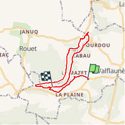

Length
13.8 km

Max alt
492 m

Uphill gradient
470 m
Km-Effort
19.7 km

Min alt
137 m

Downhill gradient
351 m
Boucle
No
Creation date :
2018-04-17 22:39:52.268
Updated on :
2018-04-17 22:39:52.268
4h26
Difficulty : Medium

FREE GPS app for hiking
 SityTrail
IGN / Geographical institutes
SityTrail Plus
The world is yours!
About
Trail Walking of 13.8 km to be discovered at Occitania, Hérault, Valflaunès. This trail is proposed by ARVIEU.
Positioning
Country:
France
Region :
Occitania
Department/Province :
Hérault
Municipality :
Valflaunès
Location:
Unknown
Start:(Dec)
Start:(UTM)
568832 ; 4849547 (31T) N.
Comments