


La grande Sure par le Col de la grande Vache

Phil36
User
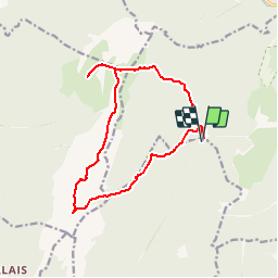

Length
14.6 km

Max alt
1902 m

Uphill gradient
868 m
Km-Effort
26 km

Min alt
1276 m

Downhill gradient
868 m
Boucle
Yes
Creation date :
2018-04-17 22:45:00.749
Updated on :
2018-04-17 22:45:00.749
5h19
Difficulty : Difficult

FREE GPS app for hiking
 SityTrail
IGN / Geographical institutes
SityTrail Plus
The world is yours!
About
Trail Walking of 14.6 km to be discovered at Auvergne-Rhône-Alpes, Isère, Proveysieux. This trail is proposed by Phil36.
Description
Cette randonnée, au départ du Col de la Charmette (cul de sac) à Proveysieux, propose des paysages d'alpages exceptionnels qui ne vous laisseront pas indifférents.
Positioning
Country:
France
Region :
Auvergne-Rhône-Alpes
Department/Province :
Isère
Municipality :
Proveysieux
Location:
Unknown
Start:(Dec)
Start:(UTM)
714700 ; 5022298 (31T) N.
Comments