


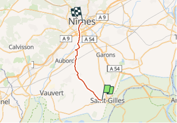
StGilles-Nîmes

gk@icedd.be
User

Length
23 km

Max alt
113 m

Uphill gradient
180 m
Km-Effort
25 km

Min alt
18 m

Downhill gradient
154 m
Boucle
No
Creation date :
2018-04-17 23:50:41.843
Updated on :
2018-04-17 23:50:41.843
1h28
Difficulty : Easy

FREE GPS app for hiking
 SityTrail
IGN / Geographical institutes
SityTrail Plus
The world is yours!
About
Trail Cycle of 23 km to be discovered at Occitania, Gard, Saint-Gilles. This trail is proposed by gk@icedd.be.
Positioning
Country:
France
Region :
Occitania
Department/Province :
Gard
Municipality :
Saint-Gilles
Location:
Unknown
Start:(Dec)
Start:(UTM)
614206 ; 4836981 (31T) N.
Comments