


Daiho-ji

betf
User
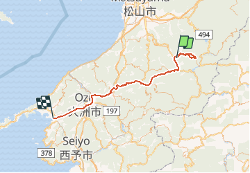

Length
86 km

Max alt
797 m

Uphill gradient
3517 m
Km-Effort
135 km

Min alt
3 m

Downhill gradient
4034 m
Boucle
No
Creation date :
2018-04-18 00:18:09.726
Updated on :
2018-04-18 00:18:09.726
6h45
Difficulty : Medium

FREE GPS app for hiking
 SityTrail
IGN / Geographical institutes
SityTrail World
The world is yours!
About
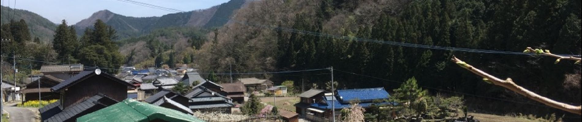
Trail Walking of 86 km to be discovered at Ehime Prefecture, Kamiukena County. This trail is proposed by betf.
Photos

Positioning
Country:
Japan
Region :
Ehime Prefecture
Department/Province :
Kamiukena County
Municipality :
Unknown
Location:
Unknown
Start:(Dec)
Start:(UTM)
306083 ; 3726459 (53S) N.
Comments
Trails nearby