


Balade autour d'Evron

Axelloceane
User


3h02
Difficulty : Easy

FREE GPS app for hiking
 SityTrail
IGN / Geographical institutes
SityTrail Plus
The world is yours!
About
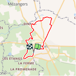
Trail Walking of 12.7 km to be discovered at Pays de la Loire, Mayenne, Évron. This trail is proposed by Axelloceane.
Description
départ du camping en suivant le circuit des marais ensuite prendre direction plan d''eau du gué De Selle.Au croisement sentier direction St Gemmes Le Robert retour par la route et une petite visite de la ville
Positioning
Comments