


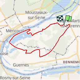

10.9 km | 14.7 km-effort


User


FREE GPS app for hiking
 SityTrail
IGN / Geographical institutes
SityTrail World
The world is yours!
Trail Walking of 14.2 km to be discovered at Ile-de-France, Yvelines, Saint-Martin-la-Garenne. This trail is proposed by domelisa78.
Walking

On foot
Mountain bike

Walking
Walking
Walking
Walking
Nordic walking
Walking
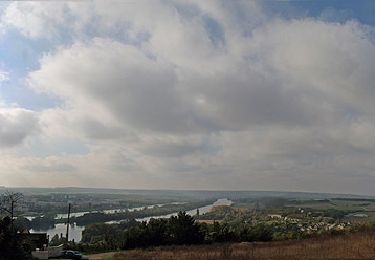
Un très joli parcours, facile mais varié. A noter qu'après le deuxième kilomètre, il n'est plus possible de quitter la route vers la gauche, au sud. La carrière est en exploitation et le chemin est fermé par une barrière. Il faut donc continuer sur la route en suivant le PR jusqu'à Sandrancourt.