


cascade de la roche

flux99
User

Length
2 km

Max alt
282 m

Uphill gradient
22 m
Km-Effort
2.3 km

Min alt
260 m

Downhill gradient
18 m
Boucle
No
Creation date :
2014-12-10 00:00:00.0
Updated on :
2014-12-10 00:00:00.0
--
Difficulty : Very easy

FREE GPS app for hiking
 SityTrail
IGN / Geographical institutes
SityTrail Plus
The world is yours!
About
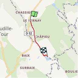
Trail Walking of 2 km to be discovered at Auvergne-Rhône-Alpes, Isère, Charette. This trail is proposed by flux99.
Description
cascade de la roche et cyprès chauves(rouge très belle vue en automne)


Positioning
Country:
France
Region :
Auvergne-Rhône-Alpes
Department/Province :
Isère
Municipality :
Charette
Location:
Unknown
Start:(Dec)
Start:(UTM)
683132 ; 5073893 (31T) N.
Comments